Released 24/02/2017 10:00 am
Copyright contains modified Copernicus Sentinel data (2016-17), processed by ESA
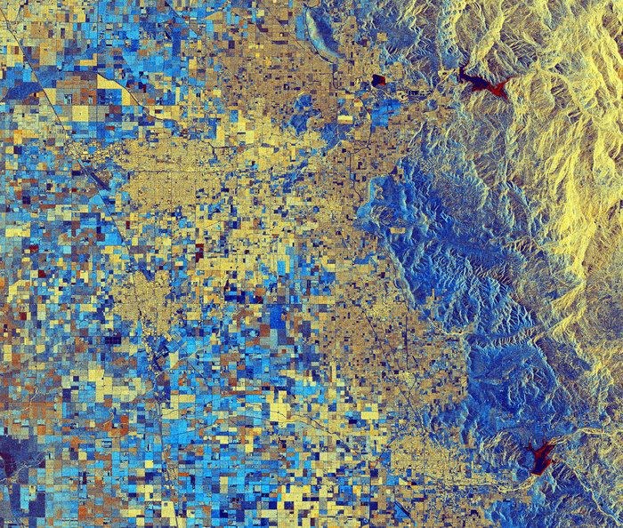
California has seen some heavy rains recently after years of drought, filling many of the state’s reservoirs. The rising waters are evident in this radar image from the Copernicus Sentinel-1 satellite mission over part of the San Joaquin Valley.
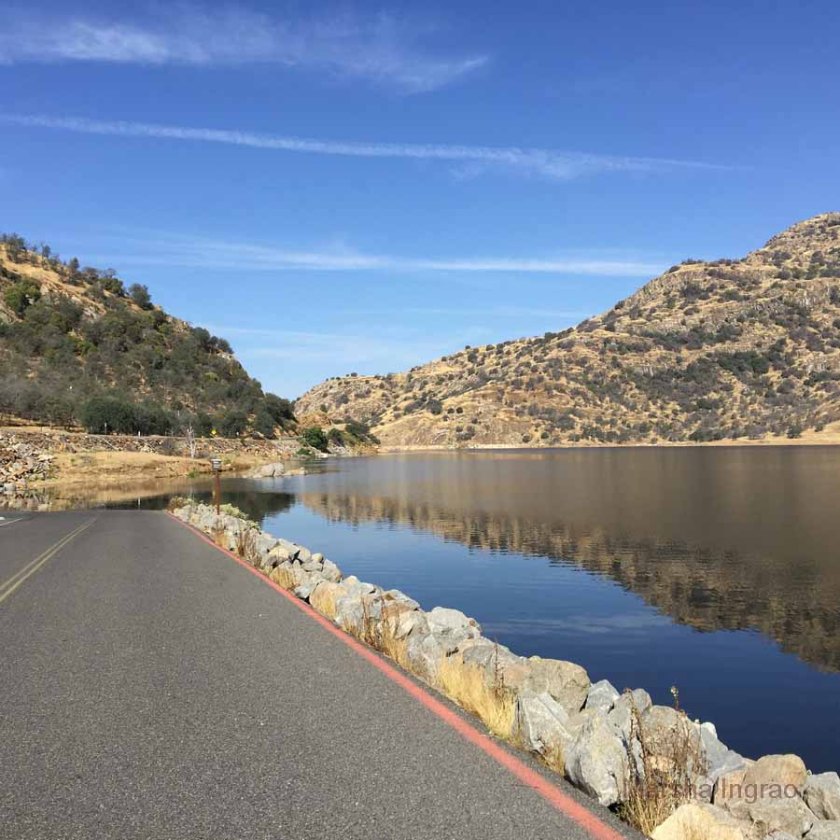 |
| water in Kaweah Lake almost up to the road mirroring the hills |
 |
| Bravo Lake filled this winter. |


The problem of too much water is in stark contrast from the situation in previous years, when drought led to water shutoffs and cutoffs, severely hindering yields in the San Joaquin Valley – a major agricultural region. Major crops include grapes, cotton, nuts and fruits, with productivity relying on irrigation from surface water diversions and groundwater pumping from wells.
Agricultural structures dominate this radar composite image. Like the reservoirs, colours reveal changes between December and January such as vegetation growth or harvests.
Along the right side of the image, we can see the foothills of the Sierra Nevada mountains.
This image is also featured on the Earth from Space video programme.
Earth from Space: Lake Success - YouTube
Published on Feb 24, 2017
Earth from Space is presented by Kelsea Brennan-Wessels from the ESA Web-TV virtual studios. Radar imagery from Sentinel-1 shows us how recent rains in California have increased reservoir water levels in the 218th edition.
See also http://www.esa.int/spaceinimages/Imag... to download the image.
See also http://www.esa.int/spaceinimages/Imag... to download the image.
Related/Background:
- Lake Kaweah: Water level on the rise | The Kaweah Commonwealth
- Bravo Lake – Marsha Ingrao
- Major Reservoir Current Conditions Graphs
- Oroville Dam: Here's the water level in other California reservoirs
- Satellites confirm sinking of San Francisco tower / Sentinel-1 / Copernicus / Observing the Earth / Our Activities / ESA
- spendergast: Sentinel-1+1A 2 Pass SAR Interferogram shows Italy earthquake displacement
- spendergast: NASA Sets SpaceX to Launch SWOT Mission RADAR Satellite
1 comment:
Pokemon go level rewards Tips
Tips and Cheats poke mon
Go app 2017-2018 pokevision
hack Pokémon go for the android devices
pokevision Go Hacking 2017-2018
Pokevision Go Hack Android 2017-2018
Post a Comment