Wednesday, August 31, 2016

Building Trust key to pushing Autonomous Military Technology past "Tipping Point"


goals are maturing rapidly, the Defense Science Board said in a newly published study.


“Autonomy, fueled by advances in artificial intelligence, has attained a ‘tipping point’ in value,” the DSB study said. “Autonomy will deliver substantial operational value–in multiple dimensions–across an increasingly broad spectrum of DoD missions, but the DoD must move more rapidly to realize this value. Allies and adversaries alike also have access to increasingly rapid technological advances occurring globally,” the study said.

The recommendations of the study are briefly outlined in Table 4 at the end of the report, on page 102. Details for each recommendation are included in the relevant chapter sections and provide additional information to assist with their implementation. The Board recommended that the Department of Defense undertake a series of pilot projects “intended to demonstrate the range of benefits of autonomy for the warfighter.”

Establishing Trust is key to Autonomy

The Pentagon’s science advisers want military robots to operate with far greater autonomy than they do today. Only one problem: There’s a cloud of distrust and misunderstanding hovering over the robots that the Pentagon already has.

That’s an unexpected conclusion in a July study from the Defense Science Board, recently acquired by Steve Aftergood of the Federation of American Scientists. The Board wondered what’s inhibiting the development of autonomous military vehicles and other systems. It found that the humans who have to interact with robots in high-stakes situations often labor under the misimpression that autonomy means the machine can do a human’s job, rather than help a human do her job more efficiently. And some simply don’t have faith that the robots work as directed.

The issue of trust is core to DoD’s success in broader adoption of autonomy. On the one
hand, an autonomous system must be designed to operate in a trustworthy fashion with respect to the missions for which it was designed. On the other hand, an autonomous system must be designed so that humans (and/or machines) can straightforwardly determine whether, once it has been deployed, it is operating reliably and within its envelope of competence — and, if not, that appropriate action can be taken. Establishing trustworthiness at design time and providing adequate capabilities so that inevitable variations in operational trustworthiness can be assessed and dealt with at run time is essential, not only for operators and commanders, but also for designers, testers,
policymakers, lawmakers, and the American public. The broad topic of trust shaped many of the recommendations that follow.
The first set of recommendations focuses on accelerating DoD’s adoption of autonomous
capabilities and includes:
  • Tackling the engineering, design, and acquisition challenges
  • Mitigating cyber issues introduced by increasingly autonomous and networked systems
  • Creating new test and evaluation and modeling and simulation paradigms
  • Integrating technology insertion, doctrine, and concepts of operations
  • Developing an autonomy-literate workforce
  • Improving technology discovery 
  • Improving DoD governance for autonomous systems
  • Countering adversary use of autonomy
These interdependent recommendations are intended to build trust in autonomous systems,
while at the same time accelerating DoD’s progress.

strengthen the operational pull for autonomy

The next set of recommendations focuses on strengthening the operational pull for autonomy, both by better understanding how others may use autonomy against the U.S., and by equipping our forces to counter such capabilities. These recommendations take the form of a series of demonstrations and experiments that demonstrate near-term military value while also building warfighter trust:
  • Autonomous agents to improve cyber-attack indicators and warnings
  • Onboard autonomy for sensing
  • Time-critical intelligence from seized media
  • Dynamic spectrum management for protection missions
  • Unmanned undersea vehicles (UUVs) to autonomously conduct sea mine counter-measures missions
  • Automated cyber response
  • Cascaded UUVs for offensive maritime mining
  • Organic tactical unmanned aircraft (UA) to support ground forces
  • Predictive logistics and adaptive planning
  • Adaptive logistics for rapid deployment

expand the envelope of technologies

The final set of recommendations is intended to expand the envelope of technologies available
for use on DoD missions. “Stretch problems” are proposed as a means to both strengthen the
operational pull and mature the underlying technologies, such that they would be trusted for
application on DoD missions:
  • Early warning system for understanding global social movements
  • Autonomous swarms that exploit large quantities of low-cost assets
  • Intrusion detection on the Internet of things
  • Autonomous cyber resilience for military vehicle systems
  • Autonomous air operations planning

Previously, In the 2012 final study on Autonomy, DSB said:

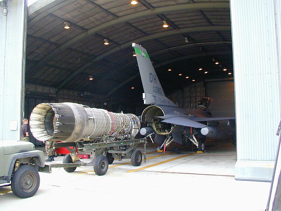
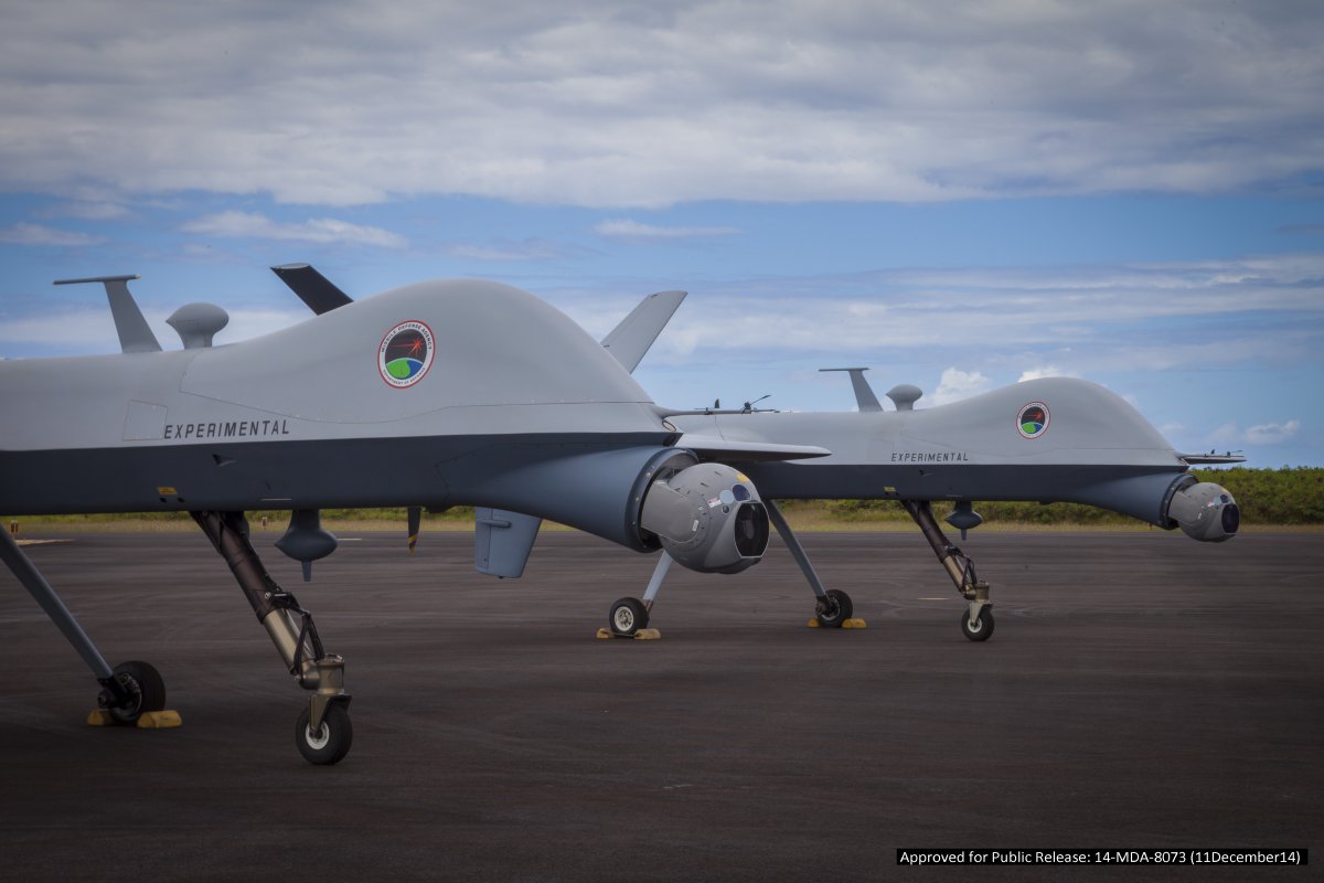
Unmanned systems are proving to have a significant impact on warfare worldwide. The true value of these systems is not to provide a direct human replacement, but rather to extend and complement human capability in a number of ways. These systems extend human reach by providing potentially unlimited persistent capabilities without degradation due to fatigue or lack of attention. Unmanned systems offer the warfighter more options and flexibility to access hazardous environments, work at small scales, or react at speeds and scales beyond human capability. With proper design of bounded autonomous capabilities, unmanned systems can also reduce the high cognitive load currently placed on operators/supervisors. Moreover, increased autonomy can enable humans to delegate those tasks that are more effectively done by computer, including synchronizing activities between multiple unmanned systems, software agents and warfighters —thus freeing humans to focus on more complex decision making.

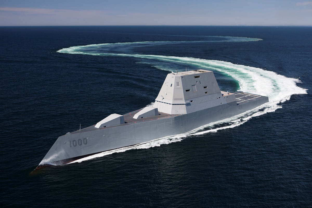
While the potential of autonomy is great, there have been many obstacles to general broad acceptance of unmanned systems, and, specifically, the autonomous capabilities needed to realize the benefits of  autonomy in military applications. Most Department of Defense (DoD) deployments of unmanned systems have been motivated by the pressing needs of conflict, particularly the threat of improvised explosive devices and the need for persistent intelligence, surveillance and reconnaissance (ISR) data collection. To date, most of the demonstrated benefits of autonomous systems have been in air or ground applications, but there exists no reason that they could not be effective in maritime and space missions as well.

The Task Force was charged to assist the DoD in understanding and preparing to take maximum practical advantage of advances in autonomy by reviewing relevant technologies, ongoing research and the current autonomy-relevant plans of the Military Services. The Department asked the Task Force to identify new opportunities to more aggressively use autonomy in military missions, to anticipate vulnerabilities and to make recommendations for overcoming operational difficulties and systemic barriers to realizing the full potential of autonomous systems.

Related/Background:

Monday, August 29, 2016

Sentinel-1+1A 2 Pass SAR Interferogram shows Italy earthquake displacement

Interferogram showing the ground deformation caused by the |
August 24, 2016 earthquake in Italy. Source: modified
Copernicus Sentinel data (2016)/ESA/ CNR-IREA.
This Interferogram Shows Ground Displacement in Italy as a Result of the Recent Earthquake - Geolounge
The European Space Agency posted this interferogram showing ground displacement as a result of the recent earthquake in Italy.  The magnitude 6.2 earthquake struck central Italy during the early morning hours on August 24.  The epicenter was about 10 kilometers southeast of Norcia, Italy and resulted in over 200 deaths to date and massive damage to the medieval towns in the area. More than 1,000 aftershocks have continued to exacerbate problems in the region.
The European Space Agency’s Sentinel-1 captured two radar scans of central Italy, one on August 20th (Sentinel-1B) and the second on August 26th (Sentinel-1a).
Space in Images - 2016 - 08 - Italy earthquake displacement
  • Title Italy earthquake displacement
  • Released 26/08/2016 5:31 pm
  • Copyright Contains modified Copernicus Sentinel data (2016)/ESA/ CNR-IREA
  • Description Combining two Sentinel-1 radar scans from 20 August (Sentinel-1B) and 26 August 2016 (Sentinel-1A), this interferogram shows changes that occurred during the 24 August earthquake that struck central Italy.
    The seven interferometric ‘fringes’ correspond to about 20 cm of surface deformation in the radar sensor line of sight.  Each fringe (which is associated to a colour cycle) corresponds to approximately 2.8 cm of displacement.
    Although Sentinel-1 has a swath width of 250 km over land surfaces, its pass over Italy on 26 August did not cover the entire area affected. Another acquisition planned for 27 August will cover the entire earthquake zone.

Related/Background:

Saturday, August 27, 2016

Israel's RADA Counter-UAV RPS-42 Radar picked by US and Asian Customers

South Korea to purchase 10 Israeli radars to beef up air surveillance - YouTube


Asian Air Defense Chooses RADA Counter-UAV Radar - UAS VISION
RADA Electronic Industries Ltd. has announced its selection by an Asian military force of its Multi-Mission Hemispheric Radar (MHR) based RPS-42 aerial surveillance radar systems. RADA’s systems will provide the customer’s Air Defense with highly advanced aerial surveillance capabilities, enabling the detection of Unmanned Aerial Vehicles (UAV). 


RADA’s RPS-42 Tactical Volume Surveillance Radar System, based on its Multi-Mission Hemispheric Radar (MHR), detects, tracks and classifies micro and mini UAS (Groups 1&2) at ranges of up to 10km. It accurately tracks the threats up to very high elevation angles, operates on-the-move, and introduces unprecedented performance-to-price ratio. In addition to UAVs and short-range RAM (Rockets, Artillery and Mortars), the system also detects and tracks other aerial targets, including fighter and transporter aircraft, helicopters, etc.

The uniqueness of the RPS-42 system lies in its ability to detect exceptionally small, low and slow-flying UAS - categorized as significant tactical threats to maneuver forces - which cannot be detected by most existing air defense radars. Advanced VSHORAD systems, especially those based on Directed Energy, require compact tactical radars that are able to detect these and other threats, operate on-the-move, and provide vital real-time threat information to the fire control system. All these critical capabilities are provided by the RPS-42 system - delivering volume surveillance and detection of multiple threat types, including the smallest threats.

RADA's MHR radar has been undergoing field testing since May 2012.
Initial deliveries are expected before year's end. Photo: RADA.
The MHR – an S Band, Software-Defined, Pulse-Doppler, AESA radar – is a digital radar platform which is GaN based and introduces sophisticated beam forming capabilities and advanced signal processing. It provides multiple missions on each radar platform and can combine C-UAS and C-RAM operational missions on the same radar, thus delivering ideal organic, tactical surveillance solutions for force protection systems.

Related/Background:

Tuesday, August 23, 2016

San Diego Woman named Man Sentenced To 50 months in Prison for Trying to Export of F-16/35/22 Jet Engines and Predator B UAV To China

Wenxia Man, aka Wency Man
CA Woman Sentenced To Prison for Conspiring To Export Fighter Jet Engines, Unmanned Aerial Vehicle To China

FLORIDA–A 45-year-old San Diego woman was sentenced August 19 to 50 months in prison for conspiring to export and cause the export of fighter jet engines, an unmanned aerial vehicle – commonly known as a drone – and related technical data to the People’s Republic of China in violation of the Arms Export Control Act.


On June 9, Wenxia Man, aka Wency Man was convicted by a federal jury in the Southern District of Florida of one count of conspiring to export and cause the export of defense articles without the required license.


Pratt & Whitney begins delivery of next generation F100 engines
According to evidence presented at trial, between approximately March 2011 and June 2013, Man conspired with Xinsheng Zhang, who was located in China, to illegally acquire and export to China defense articles including:

  • Pratt and Whitney F135-PW-100 engines used in the F-35 Joint Strike Fighter; 
  • Pratt & Whitney F119-PW-100 turbofan engines used in the F-22 Raptor fighter jet; 
  • General Electric F110-GE-132 engines designed for the F-16 fighter jet; 
  • the General Atomics MQ-9 Reaper/Predator B Unmanned Aerial Vehicle, capable of firing Hellfire Missiles; 
  • and technical data for each of these defense articles.
During the course of the investigation, when talking to an undercover HSI agent, Man referred to Zhang as a “technology spy” who worked on behalf of the Chinese military to copy items obtained from other countries and stated that he was particularly interested in stealth technology.

Related/Background:


Sunday, August 21, 2016

GPR helps find Fabulously rich Bronze Age grave in Cyprus

Hala Sultan Tekke: A Late Bronze Age Town in Cyprus |
The History Blog » Blog Archive » Fabulously rich Bronze Age grave found in Cyprus

Hala Sultan Tekke was one of the largest cities in the Late Bronze Age. It was inhabited from 1600 through 1150 B.C. and radar surveys have found that at its peak it was up to 50 hectares in area. The prosperous city benefited from extensive trade connections that reached as far as Sweden. The great number and variety of artifacts found in the tomb didn’t travel quite that far, but they attest to the availability of luxury imports in the Late Bronze Age city. The archaeological team found evidence in the city proper of textile production and purple dying on an industrial scale.


Hala Sultan Tekke revisited–archaeological GPR prospection on Cyprus 1980 and 2010/12 | Immo Trinks - Academia.edu

Hala Sultan Tekke is situated near the town of Larnaca in Cyprus, south of the Salt Lake, which is separated from the Mediterranean Sea by the airport. The site is named after the nearby Mosque of Umm Haram, which is an important Muslim shrine. Excavations here have been carried out by Swedish archaeologists since the 1970s. In 1980, one of the very first applications of a ground penetrating radar (GPR) system in European archaeology took place at Hala Sultan Tekke. That survey was carried out by Peter M. Fischer using a simple analogous radar system, resulting in data showing reflections from underground structures that later excavation confirmed as walls of Bronze Age structures. The considerable development of the GPR hardware, data processing and visualization methods over the past 30 years have opened new possibilities for the use of the GPR method in archaeological prospection. In 2010, a successful small-scale archaeological prospection survey was conducted at Hala Sultan Tekke to evaluate the potential of high-resolution archaeological prospection using modern GPR technology and methods. The results of this study guided the subsequent archaeological excavations of the New Swedish Cyprus Expedition, directed by Peter M. Fischer, resulting in very good agreement between the predicted and excavated structures. This survey was followed by a second, larger survey in 2012. We present the GPR surveys and the potential for non-invasive geophysical archaeological prospection at one of Cyprus’ largest Bronze Age cities.

GPR Survey in 1980
2012 GPR Survey Depth Cut
Season 2013 | Swedish Archaeology in Jordan, Palestine and Cyprus, Peter Fischer
With the support of P. Georgiou, a rectangular survey grid was marked on the ground of the survey area measuring approximately 40x47 m. Between the base lines running in east-west direction, parallel survey lines were fixed with 50 cm spacing for orientation in order to guarantee exact cross-line positioning of the GPR measurements. The ground conditions, signal penetration depth and system performance of the Sensors & Software Noggin Plus 500 MHz antenna system were tested along several trial profiles. Low signal-to-noise ratio allowed the use of a trace stacking of eight instead of the standard fold of four, and to reduce the cross-line profile spacing to 12.5 cm with an in-line GPR trace spacing of 2.5 cm. The recording time window was set to 49 ns, corresponding an approximate maximum signal penetration depth of 2 to 2.5 m (assuming an average signal velocity of 8-10 cm/ns). Over the course of three days, the entire accessible survey area inside the fence was covered with 371 parallel GPR profiles, amounting to a total profile length of 18,855 m.

Related/Background:

Shoemaker evolving requirements and mission for MQ-25 UAS Carrier Fit

Next iteration of CBARS, UCLASS platform
SEAPOWER Magazine Online
Posted: August 18, 2016 9:34 AM
Navy Air Boss: Looking for ‘Sweet Spot’ in MQ-25 Unmanned Aircraft Design

By RICHARD R. BURGESS, Managing Editor

SILVER SPRING, Md. — The Navy is looking for the right balance of characteristics for its planned MQ-25A Stingray unmanned carrier-based aircraft for its missions and carrier handling, the Navy’s air boss said.

Vice Adm. Mike Shoemaker, commander, Naval Air Forces, speaking Aug. 12 to an audience at the Center for Strategic and International Studies, a Washington think tank, said the defense industry responses to the Navy’s request for proposals for the MQ-25A have been received.

MQ-25 Unmanned Aircraft Poses Design Challenges for Navy, Industry - Blog

The Navy and its industry partners are faced with major design challenges as they seek to develop a dual-mission, carrier-launched drone, the commander of Naval Air Forces said Aug. 18.

The MQ-25 Stingray is expected to perform tanking missions as well as intelligence, surveillance and reconnaissance. The Navy sent out a request for proposals last month and responses from industry have been received, Vice Adm. Mike Shoemaker said at a conference hosted by the Center for Strategic and International Studies.

“As I talked to those industry partners, I realized … designs to do one or those other mission sets alone are different,” he said.

For the ISR mission, you ideally want a high-endurance platform with a large wingspan and “probably not a lot of fuel on board,” he noted.

But “if you’re going to be a tanker at range, you’ve got to obviously be able to carry a fair amount of fuel internal to the platform. So that drives a different design for those two” missions, he said.
The Defense Department has commissioned a tanker study to examine the problem.

“We’re kind of looking at where the trade space is,” Shoemaker said. “It’s really to get at the design of the two mission sets we think that airplane will do.”

GAO Report UCLASS Sees Progress CBARS | French Navy Seizes Somalia Bound Weapons Cache | 490 Participants, 47 Countries Attend Defexpo India 2016

The US Government Accountability Office (GAO) has published its annual report external link on the the Navy’s Unmanned Carrier-Launched Airborne Surveillance and Strike (UCLASS) program, as authorized by the National Defense Authorization Act for Fiscal Year 2014. By analyzing the DOD budget for FY 2017 and speaking to program officials, the GAO found that the U.S. Navy has begun to develop modifications to existing shipboard systems to support the UCLASS’ latest iteration – Carrier Based Aerial Refueling System (CBARS). As with the UCLASS program, CBARS will include an air system segment, an aircraft carrier segment, and a control system and connectivity segment. 

WEST: NAVAIR’s Unmanned Aerial Tanker Acquisition Will Be Leaner Than Previous UCLASS Effort - USNI News

NAVAIR’s Vice Adm. Paul Grosklags said the pursuit of the RAQ-25 UAV – currently dubbed the Carrier Based Aerial Refueling System (CBARS) – would take the work from the UCLASS acquisition and streamline the process – one burdened with a high level of requirements churn to
industry.


“We end up giving to industry, giving to you all a specification — a statement of work — that literally contains thousands of shall statements. And every one of those shall statements is of equal
importance because if you don’t comply with it you’re not complying with the terms of the contract. Thousands of them,” Grosklags said at the WEST conference on Thursday.

“What we’re doing with RAQ-25 is we’ve taken those thousands of shall statements down to a couple of hundred. We’re streamlining the team. We’re taking the typical hundreds of NAVAIR folks that would be working on a program like that and bringing it down to dozens. That is the culture change that we’re trying to get to with inside NAVAIR.”

Related/Background:

Saturday, August 20, 2016

US releases Presidential Policy Guidance (PPG) UAV lethal strike 'playbook'

Reaper launches Hellfire Missiles


How did the concept of global reach for a killer drone originate

As with many other things, the law is trying to catch up with technology. The creation of the first weapon in history whose operators can stalk and kill an individual enemy on the other side of the globe with no personal risk was far more than clever engineering. As Richard Whittle shows in Predator, it was one of the most profound developments in the history of military and aerospace technology. From chapter 9 on, he shows how the CIA and Air Force Big Safari, driven by the hunt for Bin Laden, overcame legal resistance, organizational, operational, and technical problems with sensors, weapons, and C3I to develop the armed RPV capability. Now the government is trying to update international and domestic law to leash this capability.

Once considered fragile toys, drones were long thought to be of limited utility. The Predator itself was resisted at nearly every turn by the military establishment, but a few iconoclasts refused to see this new technology smothered at birth. The remarkable cast of characters responsible for developing the Predator includes a former Israeli inventor who turned his Los Angeles garage into a drone laboratory, two billionaire brothers marketing a futuristic weapon to help combat Communism, a pair of fighter pilots willing to buck their white-scarf fraternity, a cunning Pentagon operator nicknamed "Snake," and a secretive Air Force organization known as Big Safari. When an Air Force team unleashed the first lethal drone strikes in 2001 for the CIA, the military's view of drones changed nearly overnight.


Grading the Obama Administration's Progress on Drone Policy - Lawfare
In his May 2013 speech at National Defense University, President Obama called for new ways to think about drones and the United States’ policy on using these systems in counterterrorism operations. Now, nearly 3 years later, the Obama administration is in danger of leaving a legacy on drones that is long on rhetoric but short on substance.

The Stimson Center heeded President Obama’s call and in June 2014, the Stimson Task Force on U.S. Drone Policy released a report and eight detailed and concrete recommendations designed to ensure that U.S. drone policy is transparent, accountable, and consistent with long-term U.S. national security goals, foreign policy ideals, and commercial interests. In the 18 months since the release of the Task Force report, Stimson analyzed the administration’s progress towards implementing these recommendations and assigned “grades” based on this progress. On February 23, Stimson launched this “report card,” which describes steps taken by the administration to implement the task force’s recommendations based on publicly available information. In sum, the report card reveals that the administration has failed to be more transparent and more accountable with regard to its use of armed drones and its lethal drone policy. The administration has failed to develop robust oversight and accountability mechanisms, including by not publicly releasing the legal framework that supports the lethal drone program. Although the administration has assured the public that it is working towards greater oversight and accountability, there have been few examples of such improvements in practice.
  1.  – Conduct a strategic review and cost-benefit analysis of the role of lethal drones in targeted counterterrorism strikes - U.
  2.  – Improve transparency in Targeted UAV strikes – D (with subgrades of C, F, and F).
  3.  – Transfer general responsibility for lethal drone strikes from the CIA to the military - D.
  4.  – Develop more robust oversight and accountability mechanism for targeted strikes outside of traditional battlefield – F (with sub-grade of U).
  5.  – Foster the development of appropriate international norms for use of lethal force outside of traditional battlefields - D.
  6.  – Assess UAV-related technological developments and likely future trends, and develop an interagency research and development strategy geared toward advancing US national security interests in a manner consistent with US values - U.
  7.  – Review and reform UAV-related export control and FAA rules - C.
  8.  – FAA should accelerate its efforts to meet the requirements of the 2012 FAA Reauthorization Bill - C.
the report provides 6 pragmatic and achievable steps—based in part on the task force’s original recommendations—that the administration could take now to help ensure a sensible and comprehensive U.S. drones policy.
  1. Release the Presidential Policy Guidance on “U.S. Policy Standards and Procedures for the Use of Force in Counterterrorism Operations Outside the United States and Areas of Active Hostilities” to provide the basic framework for U.S. drone strikes.
  2. Conduct a publicly available strategic review and cost-benefit analysis of lethal drone strikes, particularly in counterterrorism operations.
  3. Provide the domestic and international legal framework for the U.S. drone program, including the release of the legal memos undertaken by the Office of Legal Counsel, the CIA, and DoD that contain the interpretations used by the United States with regards to international humanitarian law and international human rights law.
  4. Provide historical data, even in aggregate and after strikes have occurred, regarding the specific details of U.S. lethal drone strikes, including the number of strikes in a particular location, the number of casualties, and who conducted the strikes.
  5. Set out high-level thoughts on an international law framework for drone use, and a clear and distinct negotiating process to work toward that framework.
  6. Propose a revised scope of ITAR/USML coverage for UAVs, in the context of the ongoing USML list reform exercise.
Obama releases drone strike 'playbook' - POLITICO
President Barack Obama has to personally approve the killing of a U.S. citizen targeted for a lethal drone strike outside combat areas, according to a policy Obama adopted in 2013.

The president also is called upon to approve drone strikes against permanent residents of the U.S. and when "there is a lack of consensus" among agency chiefs about whom to target, but in other cases he is simply "apprised" of the targeting decision, the newly-disclosed document shows.

The presidential policy guidance on drone strikes, often called the drone "playbook," was disclosed in an edited form Friday night in response to a Freedom of Information Act lawsuit brought by the American Civil Liberties Union.

Are There Any Limits on Obama’s Drone War, Really? | New Republic
From the very first line, the document seems unclear about its objective. “This Presidential Policy Guidance (PPG) establishes the standard operating procedures for when the United States takes direct action,” it starts, effectively asserting that it is both a document about policy—laying out what rules have to be followed—and a document about the procedures needed to implement that policy. That’s not the way policies and procedures are supposed to work: one is a high-level document, the other a more granular implementing one. Here they mix.
After a page and a half laying out “principles and priorities” for direct action, eight sections lay out procedures associated with those principles. In the sections pertaining to lethal targeting of high-value and other targets, additional policies are embedded. And right in the middle of it all, Section 5 “sets forth the procedures for approving proposals that vary from the policy guidance otherwise set forth in this PPG.” In other words, the exceptions to the rules that have just been laid out.
The sections that deal with lethal targeting are problematic in themselves, reversing the logic of consideration. If your goal is truly to prioritize capturing a suspected terrorist, rather than killing him, a procedure should start by asking whether someone can be captured. If so, it should move on to the process of deciding what to do with him once the U.S. gets him. Here, the PPG process starts when an agency decides to use lethal force against the target.

US releases redacted drone strike 'playbook'

The US government has released a once-secret policy document once dubbed "the playbook" that shows how officials select drone targets in areas outside war zones and the key role the president has in the process.

The 18-page Presidential Policy Guidance (PPG), published Saturday by the American Civil Liberties Union, provides more details than the government had previously revealed on how drone strikes are approved.

"Actions, including lethal action against designated terrorist targets, shall be as discriminating and precise as reasonably possible," the PPG states.

President Barack Obama typically must personally sign off on plans to strike terror suspects who are located outside war zones in which America is officially fighting. Such zones include Pakistan, Libya, Somalia and Yemen.

Strikes in combat theaters such as Iraq, Syria and Afghanistan are controlled by the military.

Each case for action is subjected to legal review before it goes to the National Security Council and then the president.

The government’s treatment of civilian casualties in counterterrorism operations [updated] | Just Security
The government has just released two important documents. One is an assessment by the Director of National Intelligence of the cumulative civilian casualties from U.S. counterterrorism “strikes” outside areas of active hostilities — which it defines as all nations apart from Afghanistan, Iraq, and Syria — from January 2009 through 2015. The other document is an Executive Order issued by the President that requires more robust protection of civilians than international law demands in all U.S. operations, and that requires publication of an annual report assessing civilian casualties.

Zumwalt to Honor Late Marine Who Escorted Namesake's Remains

Zumwalt Will Return the Honor for Late Marine Who Escorted Remains | Military.com
Upon the USS ZUMWALT's arrival in Baltimore in October, Spiro's son, Peter, will present his father's remains to the ship's commanding officer. Following her Baltimore departure, somewhere in route to her homeport of San Diego and at the mandatory distance offshore, USS ZUMWALT will come to a dead stop. The ship's crew will then conduct a brief ceremony rendering Spiro final honors as the colonel's ashes are committed to sea. Sixteen years earlier, Colonel Michael E. Spiro, II, USMC was honored to escort Admiral Zumwalt's remains home to the Naval Academy at Annapolis. [Adm Zumwalt Funeral | Adm. Elmo Zumwalt laid to rest - tribunedigital-baltimoresun] Later this year, the USS ZUMWALT seeks to return the honor.

Wednesday, August 17, 2016

Pair of Predator UAV track BMD Target at Pacific Dragon with MTS-C EO/IR

Two Predator B RPA equipped with Raytheon Multi-spectral
Targeting Systems (MTS-C) Electro-optical Infrared (EO/IR)
turrets were used to detect and track a Ballistic Missile (BM) target
Military, NASA and JPL team observes NASA Low-density
supersonic decelerator (LDSD) test vehicle
trajectory after
its launch from US Navy's PMR facility in Kauai, Hawaii
- MC2 Diana Quinlan
GA-ASI Completes Latest Airborne Missile Defense Test
Predator B Detects and Tracks Ballistic Missile in Pacific Dragon Exercise
SAN DIEGO – 15 August 2016 – General Atomics Aeronautical Systems, Inc. (GA ASI) today announced that through a contract with the Missile Defense Agency (MDA), it executed a missile tracking test as part of the Pacific Dragon (PD) exercise held June 26-28 off the coast of the Pacific Missile Range Facility (PMRF) in Kauai, Hawaii.

Pacific Dragon is a trilateral Ballistic Missile Defense (BMD) tracking event between the U.S. Navy, Japan Maritime Self Defense Force, and Republic of Korea Navy. The biennial exercise focuses on improving tactical and technical coordination among its participants, including the detection, tracking and reporting of ballistic targets.

A pair of Predator® B RPA equipped with Raytheon Multi-spectral Targeting Systems-C (MTS-C) Electro-optical Infrared (EO/IR) turrets were used to detect and track a Ballistic Missile (BM) target as part of an ongoing program with MDA. The Predator B aircraft also participated in exercises with U.S. Navy vessels.

USAF Reapers demonstrate missile tracking capability

General Atomics says the specific Reaper element of the testing was carried out under a contract awarded by the US Missile Defence Agency (MDA), and involved the UAVs using their Raytheon Multi-Spectral Targeting System-C electro-optical/infrared turret to detect and track ballistic missile targets.

Unlike the Reaper's earlier MTS-B payload, which has short- and mid-wave infrared (IR) sensors, the C version incorporates a long-wave IR sensor. This provides a "cold body" detection capability, which can be used to track ballistic missiles during their cruise phase.

MDA contributed to a larger Pentagon effort to develop the two-color MTS-C; this added a long-wave IR detection capability. While the short- and mid-wave bands are optimal during launch and rocket burn, a long-wave detector is better for tracking cold bodies, such as missiles after burnout, or plumes and exhaust.

Packaging short-, mid- and long-wave IR detectors on the same sensor ball, however, presented complex challenges, including design of proper cooling and meeting power requirements.
MDA planned to conduct a launch-on-remote exercise. “To demonstrate launch on remote, we will provide real-time tracking data to [ballistic missile defense (BMD) command-and-control] nodes,” Lehner says. “The BMD command-and-control nodes then send [the data] to Aegis in a simulated engagement.”

Carey notes that in trials thus far, ABIR has generated virtual targeting data that can be compared against data from other sensors used in the tests. But he says more command-and-control and system architecture work is needed to make the system operational.


“The test provided valuable data in our ongoing effort to develop an effective airborne missile defence capability,” Linden Blue, the UAV manufacturer's chief executive says.

The MDA is exploring the use of UAVs in missile defence as a more flexible and low-cost option for intercepting ballistic weapons.

“By leveraging unmanned aerial vehicles and space assets for pervasive over-the-horizon sensor netting, the engagement zone of current [Raytheon] Standard Missile-3 interceptors can be extended to the pre-apogee portion of a missile's trajectory,” the agency says.

 Related/Background

Monday, August 15, 2016

Power of GaN builds Space Fence Radar

Space Fence radar site
(a) cutaway of the transmit array
(b) and cross-section of the “radar-on-a-board” transmit LRUs (c).
Space Fence Radar Leverages Power of GaN | 2016-08-15 | Microwave Journal
While Digital Beam Form (DBF) systems such as Space Fence represent a significant capability upgrade, the challenges from the increased IC design complexity in the areas of size, weight and power (SWAP), bandwidth and latency performance must be overcome. To address this, programs such as DARPA’s Diverse Accessible Heterogeneous Integration (DAHI) program are focused on developing chip-scale integration of GaN with high density Si CMOS, as well as other technologies such as InP and MEMS. These resulting capabilities will enable the wider proliferation of the high performance mixed-signal integration solutions required to develop the capabilities to further advance state-of-the-art sensor systems.

The next generation of GaN development is focused around increasing capability by pushing into higher operating frequencies, improving thermal performance and enabling chip-scale integration of GaN with other IC technologies. Developments of 150 nm and 90 nm process nodes will extend ft to 60 and 100 GHz, respectively.

While GaN is capable of generating extremely high RF power densities, thermal management remains a significant challenge, especially at higher frequencies where thermal density is most extreme. On the DARPA IceCool program, Lockheed Martin has made tremendous gains in unlocking the ultimate potential of millimeter wave GaN by developing a micro-fluidically cooled HPA with a 3×reduction in thermal resistance compared to conventional thermal management solutions. This IceCool solution enables an 8.3 dB increase in output power for the same device, while simultaneously reducing operating temperature by increasing power-added efficiency between 2.5× and 3.5×.9 Overall, these advancements will further extend the true potential of GaN and its ability to realize tremendous capability upgrades for a wide variety of systems.

Sunday, August 14, 2016

China to keep eye on South China Sea with Hi-Res SAR Satellite launched on Long March 4C


Gaofen-3 Mockup - The SAR package
featuring a large radar antenna 18 m in length
Long March 4C launches Gaofen-3 Earth Observation Satellite | NASASpaceFlight.com
Tracking data published by the U.S. military’s Joint Space
Operations Center indicated the Long March 4C rocket placed
the Gaofen 3 satellite into orbit at an altitude of nearly
460 miles (740 kilometers). The craft is circling Earth at an
inclination of 98.4 degrees to the equator.

The long awaited launch of Gaofen-3 took place on Tuesday, lofted via the Chinese Long March-4C (Chang Zheng-4C) launch vehicle. The rocket, launched from the Taiyuan Satellite Launch Center’s LC9 Launch Complex at 22:55 UTC, successfully orbited the new addition to the Gaofen fleet of remote sensing satellites. Gaofen (meaning “High Resolution”) is a series of civilian Earth observation satellites developed and launched for the state-sponsored program known as the China High-definition Earth Observation System (CHEOS).


Designed by CAST (China Academy of Space Technology), Gaofen-3 employs the CS-L3000B bus configured with multi-polarized C-band SAR at meter-level resolution. Development of the new satellite was initiated in December 2010, with the engineering development beginning in September 2013. The satellite was completed in March 2016. The new satellite has a designed lifespan of eight years and will mainly be used by the State Oceanic Administration (SOA) of China.

China Launches SAR Satellite Capable of Protecting Sovereignty : Tech : Yibada
Talking to China Daily, China Academy of Space Technology's Gaofen 3 Project Head Xu Fuxiang explained that the satellite will be instrumental in closely monitoring marine environment as well as islands, reefs, ships and oil rigs that are located within the country's jurisdiction. Gaofen 3’s radar instrument has 12 imaging modes, ranging from wide-area imaging to close-up shots with a best resolution of 1 meter, or approximately 3.3 feet. That will allow the spacecraft to provide clear views of roads, buildings and boats, China’s official Xinhua news agency reported. As Gaofen 3 zooms around Earth, its radar instrument will scan along the satellite’s ground track, measuring microwave beams reflected off the planet’s land and water surfaces to create a map of structures, ships and urban infrastructure.

Gaofen 3 radar imaging satellite launched from Taiyuan by CZ-4C | China Space Report
The press release by CASC highlighted the versatility of Gaofen 3, which can operate in 12 different working modes, from high-resolution (1 m) to large-swatch (650 km), and from maritime imaging to combined land/water imaging. The 2,950 kg mass satellite operate on a 755 km LEO (98º inclination), with a designed operational life of 8 years, the longest among China’s LEO Earth-observation satellites. The radar package is capable of operating for up to an hour, another record in China’s radar satellites.

These images are downloaded through a high-rate data transmission link. Unlike conventional electro-optical imagery satellites, SAR satellites can operate in all-weather, day/night conditions, and can even capture images of underwater and underground targets. 

Related/Background:


Thursday, August 11, 2016

After Surgery and Radiation fail - New Hope - Gallium-68 PSMA as an imaging agent in prostate cancer recurrence

68Ga-PSMA PET/CT (a, b) and PET/MRI (c, d)images in patient 3. This is an example of the potential of MRI to clarify even moderate PSMA tracer accumulations visible on PET/CT. Tracer accumulation is visible on the PET/CT image (a yellow arrow) without correlation on the CT image (b), but pathological signals are visible on the PET/MR image (c white arrows) with correlationon the MR image (d white arrows) indicating bone metastases. a PET/CT fusion image, b CT image without contrast medium, c PET/MRI fusion image, d MR image (T1 with contrast medium and fat saturation)
Comparison of PET/CT and PET/MRI hybrid systems using a 68Ga-labelled PSMA ligand for the diagnosis of recurrent prostate cancer: Initial experience

Prostate Cancer

PSMA (Prostate Specific Membrane Antigen) 

Some of the studies presented from other centers were also very interesting. For example, PSMA is a cell surface transmembrane glycoprotein that is over-expressed in prostate cancer cells and would appear to provide a rational target for diagnostic imaging and possible directed therapy. Multiple Gallium (Ga68) labeled PSMA probes (imaging agents) have been topic of study particularly in Germany for the last few years. Researcher from Germany, Dr. Frederick Giesel, presented his work on Gallium PSMA PET in pre-treatment staging prior to radiation therapy. His study found that in 26 of 56 (46.4%) patients the treatment plan was changed after Gallium-PSMA PET imaging. This study demonstrates the significant impact that PET imaging probes can have on the treatment selection of patients with primary prostate cancer.

Prospective Comparison of 18F-Fluoromethylcholine Versus 68Ga-PSMA PET/CT in Prostate Cancer Patients Who Have Rising PSA After Curative Treatment and Are Being Considered for Targeted Therapy

Abstract

In prostate cancer with biochemical failure after therapy, current imaging techniques have a low detection rate at the prostate-specific antigen (PSA) levels at which targeted salvage therapy is effective. 11C-choline and 18F-fluoromethylcholine, though widely used, have poor sensitivity at low PSA levels. 68Ga-PSMA (Glu-NH-CO-NH-Lys-(Ahx)-[68Ga-N,N′-bis[2-hydroxy-5-(carboxyethyl)benzyl]ethylenediamine-N,N′-diacetic acid]) has shown promising results in retrospective trials. Our aim was to prospectively compare the detection rates of 68Ga-PSMA versus 18F-fluoromethylcholine PET/CT in men who were initially managed with radical prostatectomy, radiation treatment, or both and were being considered for targeted therapy.
In patients with biochemical failure and a low PSA level, 68Ga-PSMA demonstrated a significantly higher detection rate than 18F-fluoromethylcholine and a high overall impact on management.

Gallium-68 PSMA as an imaging agent in prostate cancer recurrence | THE "NEW" PROSTATE CANCER INFOLINK
what this study really seems to be telling us is that, like [11C]choline, [68Ga]PSMA is only reliably accurate in men whose PSA level is >2 ng/ml, and what we need are imaging agents that can reliably detect recurrent prostate cancer at PSA levels that are more like 0.2 ng/ml or lower.
On the other hand, [68Ga]PSMA is a lot more stable than [11C]choline, which means that at least it could be used at many different nuclear medicine centers, as opposed to having to be made, one dose at a time, to treat specific patients at specific clinics that have the manufacturing capability.

68Ga-PSMA-PET/CT in Patients With Biochemical Prostate Cancer Recurrence and Negative 18F-Choline-PET/CT. - PubMed - NCBI

68Ga-PSMA ligand PET/CT in patients with prostate cancer: How we review and report | Cancer Imaging | Full Text 

Tuesday, August 9, 2016

RADARSAT PE2 - Is it a Ship or Iceberg?

Mid-sized iceberg astern a vessel on the Grand Banks offshore
Newfoundland. (Photo: C-Core)
Is it a Ship or Iceberg?
Satellite SAR is very effective for surveilling sizeable areas of the ocean; targets identified in SAR imagery can then be verified by aerial reconnaissance, minimizing unnecessary but costly deployment of aircraft. Desmond Power points to the economic benefit of RADARSAT-2, adding that an oil company engaged C CORE for the first time this year in order to save money. “Satellite monitoring is a way to save money compared sending a vessel out there,” he says. “You can surveil up to 250,000 square kilometers for a couple of thousand dollars.” 
Three satellite average daily coverage of Canada (image credit: CSA)
In the Arctic, Power continues, increased variability within the seasons is producing anomalous ice environments, which together with increased maritime activity is making ship detection more complex. The technology advances that are being developed through Polar Epsilon-2 to enable increased accuracy in identifying ship and iceberg targets will assist DND in protecting Canada’s Northern waters. 

Developing the capability to discriminate between ships and icebergs in northern latitudes is a common interest shared by Canada’s Department of National Defense (DND) and the oil and gas industry. For DND, the focus is on ship detection for maritime security, whereas oil and gas companies are interested in detecting icebergs to ensure primarily the safety and also the productivity of offshore exploration and production operations.

MDA to deliver a broad-area maritime surveillance system using the RADARSAT Constellation Mission | news.sys-con.com

RICHMOND, BC, June 17, 2016 /CNW/ - MacDonald, Dettwiler and Associates Ltd. ("MDA" or the "Company") (TSX:MDA), a global communications and information company, today announced that
it has signed a CA$48.5 million (including taxes) contract with the Government of Canada to deliver an advanced broad-area global maritime and Arctic surveillance solution, called Polar Epsilon 2 (PE2), to the Department of National Defence (DND). The contract includes two years of in-service support to operate and maintain the delivered systems. The contract also has options which could increase the contract value to CA$63.1 million.

The PE2 ground systems will include ground segment systems with the capability to receive and exploit information from the RADARSAT Constellation Mission (RCM) Synthetic Aperture Radar (SAR) satellites, currently being built by MDA for the Canadian Space Agency.  PE2 will provide DND with daily maritime information over millions of square kilometers from SAR imagery, all within minutes of imaging.

Polar Epsilon
The Polar Epsilon and Polar Epsilon-2 applied R&D projects are focused on improving detection capabilities through the use of synthetic aperture radar (SAR) via RADARSAT-2 and the RADARSAT Constellation Mission (RCM)—three satellites the Canadian Space Agency is scheduled to launch in 2018. A partnership between DND and C-CORE of St. John’s, Newfoundland and Labrador is developing the expertise to use SAR imagery to differentiate between ships and icebergs. “This case clearly demonstrates the synergy that exists between the Canadian government and the oil and gas industry,” notes Desmond Power, vice-president of remote sensing at C-CORE. He explains that a year and a half ago, C-CORE completed a project in which they developed the capability to provide ice charts for the oil and gas industry, which invested $1.2 million in research. 
A cluster of vessels near Gibraltar are vividly seen in this
fine-resolution quad-polarized radar image; the more features
such as antennae on deck, the more pronounced the tell-tale
star-shaped signature. (Original image: MDA; processed by C-CORE)
Now, C-CORE is developing further expertise in this area to meet DND’s requirements. Power points out that SAR images “are not pretty Google images. They’re funky-looking echoes instead of nice shapes.” He adds that microwave radiation is a long wavelength, which doesn’t reflect back in the same way that the eyes interpret, so it’s not intuitive. Vessels show up in a diamond pattern. Bright rings in the image indicate a large supply vessel. “Our people have the experience to be able to look at images and say ‘That’s an iceberg’,” he says, “and they’re right 90 to 95 percent of the time.”

Related/Background:

  • spendergast: Canadian Maritime Domain Awareness Overview
  • Canadian Progress Toward Marine and Coastal Applications of Synthetic Aperture Radar - vachon.pdf 
  • C-CORE launches project AxES (AIS, EO and Ships) - C-CORE
  • Presentation to Arctic Patrol & Reconnaissance 2015 RadarSat Constellation Mission (RCM) - col-dooling.pdf  
  • RADARSAT-2: CANADA’S LOW KEY SPACE WORKHORSE | Ottawa Citizen 
  • DND renews contract for ship detection data | Ottawa Citizen
  • Jianchao Fan; Jun Wang "Polarimetric SAR image segmentation based on spatially constrained kernel fuzzy C-means clustering",  OCEANS 2015 - Genova, On page(s): 1 - 4
  • Lang, W.; Zhang, P.; Wu, J.; Shen, Y.; Yang, X. "Incidence Angle Correction of SAR Sea Ice Data Based on Locally Linear Mapping",  Geoscience and Remote Sensing, IEEE Transactions on, On page(s): 3188 - 3199 Volume: 54, Issue: 6, June 2016
  • Liu, H.; Li, X.; Guo, H. "The Dynamic Processes of Sea Ice on the East Coast of Antarctica—A Case Study Based on Spaceborne Synthetic Aperture Radar Data from TerraSAR-X",  Selected Topics in Applied Earth Observations and Remote Sensing, IEEE Journal of, On page(s): 1187 - 1198 Volume: 9, Issue: 3, March 2016
  • Liu, H.; Guo, H.; Zhang, L. "SVM-Based Sea Ice Classification Using Textural Features and Concentration From RADARSAT-2 Dual-Pol ScanSAR Data",  Selected Topics in Applied Earth Observations and Remote Sensing, IEEE Journal of, On page(s): 1601 - 1613 Volume: 8, Issue: 4, April 2015
  • Leigh, S.; Zhijie Wang; Clausi, D.A. "Automated Ice–Water Classification Using Dual Polarization SAR Satellite Imagery",  Geoscience and Remote Sensing, IEEE Transactions on, On page(s): 5529 - 5539 Volume: 52, Issue: 9, Sept. 2014
  • Karvonen, J. "Baltic Sea Ice Concentration Estimation Based on C-Band Dual-Polarized SAR Data",  Geoscience and Remote Sensing, IEEE Transactions on, On page(s): 5558 - 5566 Volume: 52, Issue: 9, Sept. 2014
  • Zhu, T.; Li, F.; Heygster, G.; Zhang, S. "Antarctic Sea-Ice Classification Based on Conditional Random Fields From RADARSAT-2 Dual-Polarization Satellite Images",  Selected Topics in Applied Earth Observations and Remote Sensing, IEEE Journal of, On page(s): 2451 - 2467 Volume: 9, Issue: 6, June 2016
  • Ressel, R.; Frost, A.; Lehner, S. "A Neural Network-Based Classification for Sea Ice Types on X-Band SAR Images",  Selected Topics in Applied Earth Observations and Remote Sensing, IEEE Journal of, On page(s): 3672 - 3680 Volume: 8, Issue: 7, July 2015
  • Scott, K. Andrea; Ashouri, Zahra; Buehner, Mark; Pogson, Lynn; Carrieres, Tom "Assimilation of SAR data in the marginal ice zone",  Radar Conference (RADAR), 2013 IEEE, On page(s): 1 - 5
  • Hui Zhang; Wu, Q.M.J.; Thanh Minh Nguyen; Xingming Sun "Synthetic Aperture Radar Image Segmentation by Modified Student's t-Mixture Model",  Geoscience and Remote Sensing, IEEE Transactions on, On page(s): 4391 - 4403 Volume: 52, Issue: 7, July 2014
  • Pogson, Lynn; Carrieres, Tom; Buehner, Mark; Ross, Michael "SAR data assimilation using characteristic values",  Radar Conference (RADAR), 2013 IEEE, On page(s): 1 - 5
  • Amelard, R.; Wong, A.; Fan Li; Clausi, D.A. "Unsupervised classification of sea-ice using synthetic aperture radar via an adaptive texture sparsifying transform",  Geoscience and Remote Sensing Symposium (IGARSS), 2013 IEEE International, On page(s): 3958 - 3961
  • Ashouri, Zahra; Scott, Andrea "A heuristic method to use ice andwater probabilities from SAR imagery to improve ice concentration estimates",  Geoscience and Remote Sensing Symposium (IGARSS), 2014 IEEE International, On page(s): 4868 - 4871
  • S. Ochilov and D. A. Clausi, "Operational SAR Sea-Ice Image Classification," in IEEE Transactions on Geoscience and Remote Sensing, vol. 50, no. 11, pp. 4397-4408, Nov. 2012.
    doi: 10.1109/TGRS.2012.2192278
    Abstract: Thousands of spaceborne synthetic aperture radar (SAR) sea-ice images are systematically processed every year in support of operational activities such as ship navigation and environmental monitoring. An automated approach that generates pixel-level sea-ice image classification is required since manual pixel-level classification is not feasible. Currently, using a standardized approach, trained ice analysts manually segment full SAR scenes into smaller polygons to record ice types and concentrations. Using these data, pixel-level classification can be achieved by initial unsupervised segmentation of each polygon, followed by automatic sea-ice labeling of the full scene. A fully automated Markov random field model that is used to assign labels to all segmented regions in the full scene has been designed and implemented. This approach is the first known successful end-to-end process for operational SAR sea-ice image classification. In addition, a novel performance evaluation framework has been developed to validate the segmentation and labeling of SAR sea-ice images. A trained sea-ice expert has conducted an arms length evaluation using this framework to generate a set of full-scene reference images used for testing. Testing demonstrates operational success of the labeling approach.
    keywords: {geophysical image processing;geophysical techniques;image classification;image segmentation;radar imaging;sea ice;SAR scenes;SAR sea-ice image classification;automated Markov random held model;automatic sea-ice labeling;environmental monitoring;manual pixel-level classihcation;pixel-level sea-ice image classification;polygon initial unsupervised segmentation;ship navigation;spaceborne SAR sea-ice images;synthetic aperture radar;trained ice analysts;Image classification;Image segmentation;Labeling;Markov random fields;Sea ice;Synthetic aperture radar;Image classification;Markov random field (MRF);sea ice;synthetic aperture radar (SAR);unsupervised segmentation},
    URL: http://ieeexplore.ieee.org/stamp/stamp.jsp?tp=&arnumber=6197709&isnumber=6339100 

Sunday, August 7, 2016

After hiatus, September Launch Dates Near, 10 Iridium Next Satellites stage at Vandenberg Air Force Base

It’s a big day for Iridium as the first 2 Iridium NEXT satellites
have successfully arrived at Vandenberg AFB!


Technicians load the first two Iridium Next satellites into their
shipping containers at Orbital ATK’s manufacturing facility in
Gilbert, Arizona. Credit: Iridium
File photo of a SpaceX Falcon 9 rocket on the launch pad at
Vandenberg Air Force Base, California. Credit: NASA/Bill Ingalls
With Russian launch grounded, Iridium flips order
of satellite deployments – Spaceflight Now
As September Rocket Launch Dates Near, Satellites Begin Arriving at Vandenberg Air Force Base Local News - Noozhawk.com

This year’s lull in launches from Vandenberg Air Force Base is nearing an end.

Satellite manufacturers have announced the shipment of spacecraft to the Central Coast as the base gets back into the blastoff business.

The approximately six-month interruption was the result of work involving equipment used to monitor just-launched rockets and missiles, which the base commander said would lead to a compressed but busy year.
On Aug. 2, the first two Iridium NEXT satellites left Orbital ATK’s satellite manufacturing facility in Gilbert, Ariz., arriving safely at Vandenberg after the truck trip.

Officials say the arrival marks a significant milestone toward the first launch of the Iridium NEXT constellation, which is targeted for Sept. 19 on a SpaceX Falcon 9 rocket.

Ten Iridium NEXT satellites are set to fly aboard the rocket. As the remaining eight are completed, they will be shipped two at a time to Vandenberg, officials say.

Orbital ATK employees, along with prime contractor Thales Alenia Space, assemble, integrate and test the satellites at the Gilbert manufacturing facility.

A total of 81 satellites are scheduled to roll off the assembly line, with 66 serving as the operational satellites to replace the existing Iridium network, officials said. The remainder will serve as spares, some positioned in space and others waiting on the ground to be called into service.

All Iridium NEXT satellites — which are intended to provide voice and data communications across the globe — are scheduled for launch by late 2017, the company said.

Falcon-9 • Iridium NEXT 1-10
Planned launch of first two Iridium NEXT satellites was cancelled due the problems with availability of Ukrainian Dnepr rockets and lack of agree from Russian authorities for launching Dnepr from Russian Dombarovsky Cosmodrome. ISC Kosmotras Company responsible for launching Iridium NEXT-1 and Iridium NEXT-2 satellites mission was forced to break contract – Iridium decided to combine these two satellites with mission contracted to SpaceX. Falcon-9 1.2V will lift ten Iridium NEXT earlier (mission is moved from August) then it was planned to help Iridium with replacing previous generation of Iridium satellites. First generation remains in space since 2002 when last Iridium satellite was launched. New generation satellites will help Iridium to offer best global mobile telecommunications services.

Related/Background: