Title:              Synthetic Aperture Radar (SAR) Value Added Processing for NRL Transportable Ground Terminals
Sol. #:             N00173-15-GA04
Agency:             Department of the Navy
Office:             Office of Naval Research
Location:           Naval Research Laboratory
Posted On:          Sep 18, 2015 7:32 pm
Base Type:          Sources Sought
Link:               https://www.fbo.gov/spg/DON/ONR/N00173/N00173-15-GA04/listing.html
NRL is seeking an expanded follow-on contract to the N00173-14-C-2004 contract. Contract N00173-14-C-2003 was awarded as a sole source by authority of FAR 6.302-1 to MDA Information Systems LLC, Gaithersburg MD. The Government does not intend to use FAR Part 12, Acquisition of
Commercial Items.
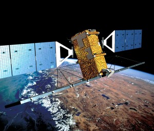 |
| Artists Concept of RADARSAT-2 |
 |
| RADARSAT-2 image modes and resolutions |
The service to be provided with this contract is for rapid, deployable access to commercial, unclassified, shareable satellite based GEOphysical INTelligence (GEOINT) data in support of the Department of Homeland Security Customs and Boarder Protection Missions. The contractor-provided services in support of NRL, together with the Government owned highly transportable satellite tracking system (NRL-supplied X-band antenna system), will support an R&D mission
here at the Naval Research Laboratory and a deployed prototype system at the Air and Marine Operations Center (AMOC) in Riverside California.
Capability Statement
Organizations responding to this RFI must be capable of tasking RADARSAT-2; licensing the sale of only derived products from the data downlinked from the RADARSAT-2; optionally, allow purchase of selected full image frames; and provide system engineering/software development to design and implement modifications to the CTAR system software.The contractor system must also be able to process the data directly downlinked from the Worldview-1 and Worldview-2 commercial satellites and process them in to standard multi-spectral imagery data products. Purchase of the Worldview-2 imagery is outside the scope of this contract, but the processing and delivery of full resolution imagery is not.
RFI Technical Questions
NRL is requesting responses to the following technical questions:- DERIVED PRODUCTS -
- Is purchasing only derived products possible from a transportable ground terminal?
- What will be the cost savings for purchasing only derived products compared to purchasing the full imagery?
- TASKING - How will the service provider support the tasking of RADARSAT and World View Satellites?
- IMAGE PROCESSING -
- How will the image processor meet the time requirement for creation of the full imagery?
- How will the size of the system be reduce to enable rapid deployment of the TGT system?
- OTHER - Are there any other derived products from SAR imagery that would be applicable to maritime domain awareness?
Related/Background
- spendergast: Canadian Maritime Domain Awareness Overview
- spendergast: SAR Imagery streams from MDA to PCI Geomatics Users
- MDA to provide RADARSAT-2 imagery to the European Space Agency | International Space Fellowship
- J&A6.302-1-13GA14 for MDA RADARSAT-2 Sole Source Award by NRL.pdf
- RADARSAT-2 Imaging Modes and Applications Webinar.pdf
- Geospatial Intelligence (GEOINT) Basic Doctrine Publication 1-0 - doctrine.pdf
- MDA Extends Provision of RADARSAT-2 Information to the Netherlands
- MDA Geospatial Intelligence Products -
The use of unclassified, shareable geospatial intelligence (GEOINT) ensures effective tasking at a far lower price point than dedicated national satellite missions. MDA is the headquarters and ground system supplier of choice for the world's leading high-resolution optical satellite operators and uses their image data in tandem with RADARSAT-1 and -2 SAR data to deliver geospatial intelligence products, including Imagery Exploitation Reports, Order of Battle Analysis, Change Detection Products, Human Activity Products, Ground Deformation Products, and Ground Cover Change Products that utilize weather-independent surveillance that reduces or denies traditional countermeasures.
GEOINT data is extracted by MDA to accurately detect and monitor military infrastructure and emplacements, civil infrastructure, borders, ports, and harbours, and is regularly used for disaster response, peacekeeping, and international sanction enforcement. - Imaging Notes Magazine || Advanced Geospatial Intelligence Products

Ships in a busy port are readily detected and classified
RADARSAT-2 data can be delivered as raw imagery or as an Advanced Geospatial Intelligence (AGI) product. AGIs are derived from a single SAR image or multiple SAR images that can be single, dual, or quad-polarized, across the range of available resolutions. The information content of the image comes from computer-based algorithms that usually require some form of operator intervention. An AGI product may be considered as a tactical decision aid if the TCPED cycle occurs within hours. In contrast, if the TCPED cycle occurs within days, the AGI product would be a strategic decision aid.
in RADARSAT-2 image.
An AGI product may entail quantitative information derived from the image or may be an annotated product containing end-user relevant features and targets. Examples of AGI products for
Thunder Bay, Ontario, Canada, RADARSAT-2 ScanSAR Narrow B with dual polarization
(Transmit VV; Receive VH; R:VH G:VH B:VV)
taken March 3, 2008.
selected defense and intelligence end users include: - Air Force: Target product showing precise target locations; digital elevation models to support mission planning
- Navy: Ocean features product for operational oceanography
- Army: Terrain mobility product depicting land
classes; coherence change detection or polarimetric change detection for
situational awareness
- Marine Corps: Coastal-zone product to support amphibious operations
No comments:
Post a Comment