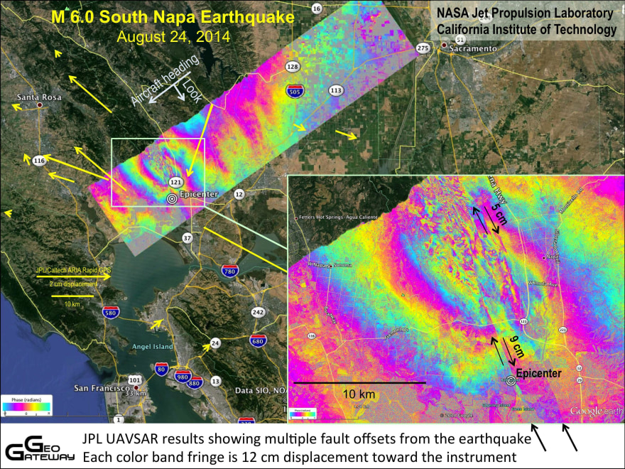
Hidden Napa Earthquake Faults Found by NASA Radar
The UAVSAR detects surface changes between repeat flights over the same spot. UAVSAR can measure ground movements of less than a half-inch (1 cm). The UAVSAR team has prepped for earthquakes by systematically mapping California's faults, starting in 2009.
With the UAVSAR data, the USGS and the California Geological Survey mapping teams discovered new areas of ground damage, Fielding told Live Science. For example, the UAVSAR team spied movement at the Napa County Airport, and geologists confirmed a small crack with less than a half-inch of slip ran across the runway.


No comments:
Post a Comment