The History Blog » Blog Archive » Fabulously rich Bronze Age grave found in Cyprus
Hala Sultan Tekke was one of the largest cities in the Late Bronze Age. It was inhabited from 1600 through 1150 B.C. and radar surveys have found that at its peak it was up to 50 hectares in area. The prosperous city benefited from extensive trade connections that reached as far as Sweden. The great number and variety of artifacts found in the tomb didn’t travel quite that far, but they attest to the availability of luxury imports in the Late Bronze Age city. The archaeological team found evidence in the city proper of textile production and purple dying on an industrial scale.
Hala Sultan Tekke revisited–archaeological GPR prospection on Cyprus 1980 and 2010/12 | Immo Trinks - Academia.edu
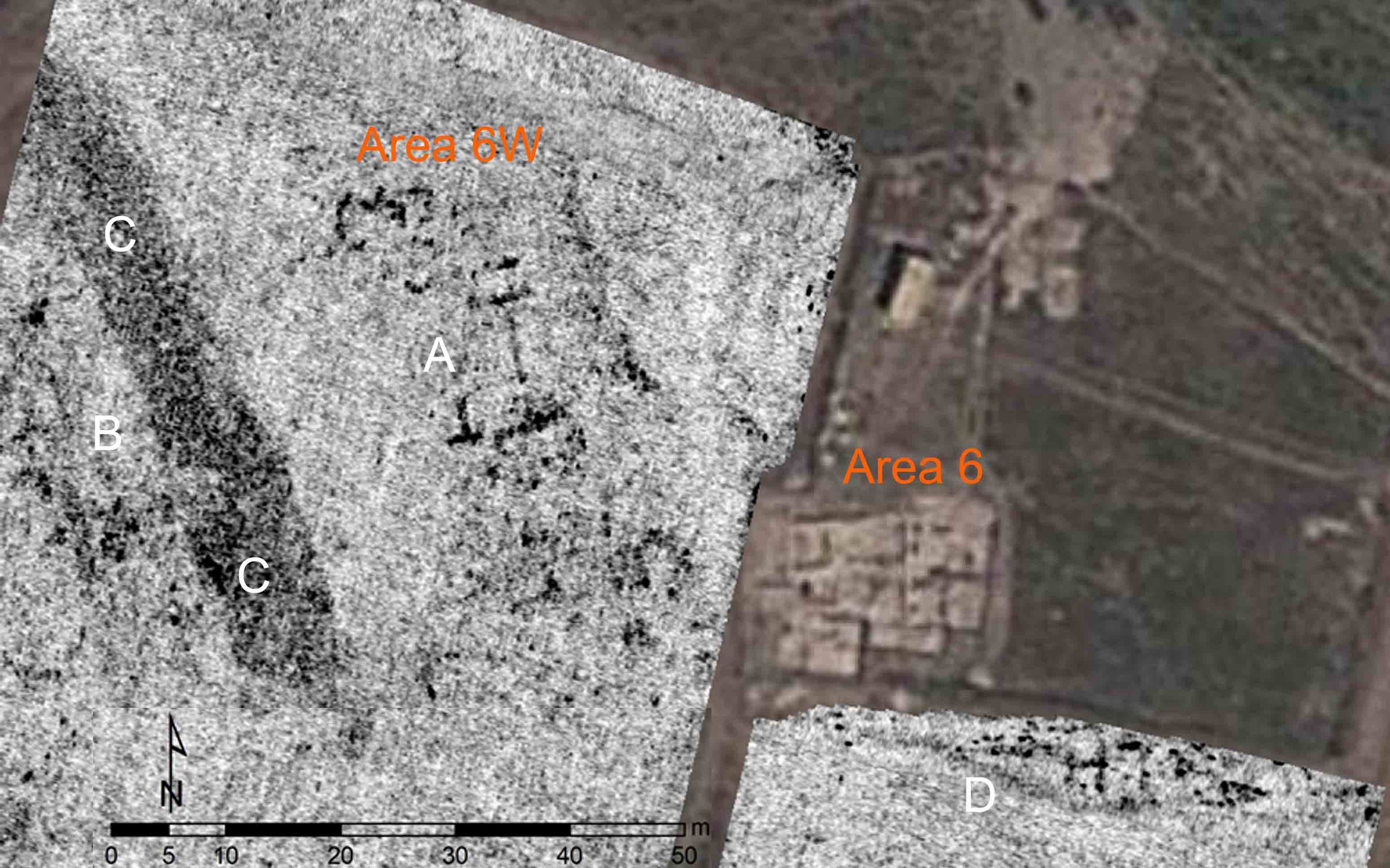
Hala Sultan Tekke is situated near the town of Larnaca in Cyprus, south of the Salt Lake, which is separated from the Mediterranean Sea by the airport. The site is named after the nearby Mosque of Umm Haram, which is an important Muslim shrine. Excavations here have been carried out by Swedish archaeologists since the 1970s. In 1980, one of the very first applications of a ground penetrating radar (GPR) system in European archaeology took place at Hala Sultan Tekke. That survey was carried out by Peter M. Fischer using a simple analogous radar system, resulting in data showing reflections from underground structures that later excavation confirmed as walls of Bronze Age structures. The considerable development of the GPR hardware, data processing and visualization methods over the past 30 years have opened new possibilities for the use of the GPR method in archaeological prospection. In 2010, a successful small-scale archaeological prospection survey was conducted at Hala Sultan Tekke to evaluate the potential of high-resolution archaeological prospection using modern GPR technology and methods. The results of this study guided the subsequent archaeological excavations of the New Swedish Cyprus Expedition, directed by Peter M. Fischer, resulting in very good agreement between the predicted and excavated structures. This survey was followed by a second, larger survey in 2012. We present the GPR surveys and the potential for non-invasive geophysical archaeological prospection at one of Cyprus’ largest Bronze Age cities.
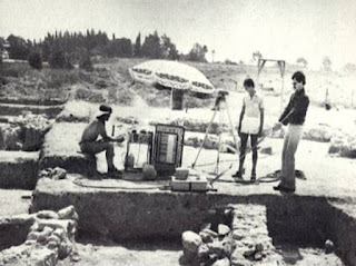 |
| GPR Survey in 1980 |
 |
| 2012 GPR Survey Depth Cut |
With the support of P. Georgiou, a rectangular survey grid was marked on the ground of the survey area measuring approximately 40x47 m. Between the base lines running in east-west direction, parallel survey lines were fixed with 50 cm spacing for orientation in order to guarantee exact cross-line positioning of the GPR measurements. The ground conditions, signal penetration depth and system performance of the
Sensors & Software Noggin Plus 500 MHz antenna system were tested along several trial profiles. Low signal-to-noise ratio allowed the use of a trace stacking of eight instead of the standard fold of four, and to reduce the cross-line profile spacing to 12.5 cm with an in-line GPR trace spacing of 2.5 cm. The recording time window was set to 49 ns, corresponding an approximate maximum signal penetration depth of 2 to 2.5 m (assuming an average signal velocity of 8-10 cm/ns). Over the course of three days, the entire accessible survey area inside the fence was covered with 371 parallel GPR profiles, amounting to a total profile length of 18,855 m.
Related/Background:


No comments:
Post a Comment